Local History
Otterburn (Northumberland)

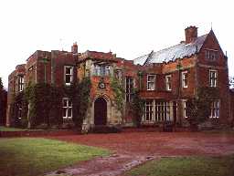
Otterburn Hall. Photo by Northumberland County Council.

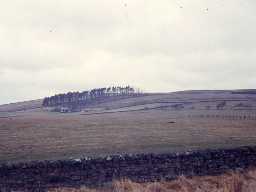
Landscape west of Otterburn. Photo by Harry Rowland.
Otterburn lies in west Northumberland in the Northumberland National Park. It has a long history, much of it associated with defence from prehistoric times to the present day. The remote and inaccessible nature of much of the parish, together with the presence of the army's Otterburn Training Area, has led to exceptional preservation of some prehistoric and later settlements and field systems.
The earliest remains in the parish are Neolithic. They include a piece of pottery and some stone tools, such as a flint, polished stone axe and axehead.
The oldest structures are Bronze Age and they are mainly ritual monuments and cairns. Many of these remains lie in places where people reused the same places in the Iron Age Roman and medieval periods, such as on Barracker Rigg. Here, a round cairn lies amongst remains of a Roman period settlement and field system. At Todlaw Pike, a round cairn and enclosed cremation cemetery have been discovered, and another round cairn cemetery stands on Levey Bog. Many more round cairns have been discovered across the parish, suggesting there was a great deal of activity here in the Bronze Age. Few bronze objects have been discovered, but those that have include a spearhead and axehead.
The oldest settlements in the parish are Iron Age. Two different types of settlement have been found in Otterburn: defended settlements on Colwell Hill and Fawdon Hill and an unenclosed hut circle settlement on Todlaw Pike. The first settlement is encircled by three ramparts and ditches, while the latter sits unprotected amidst its field system of cairnfields and small rectangular plots. None of these settlements seems to have been used in the Roman period and a series of small farmsteads appear to have been established instead. For example at Woodhill East, Wood Hill, Greenchesters, Little Crag and Barracker Rigg. On Fairney Cleugh there are at least four Roman farmsteads and one of the most extensive cord rig field systems in the county. The Roman army built two roads through this area: the High Rochester to Bridge of Aln road and Dere Street.
Otterburn also lay on medieval route ways, such as the Elsdon to Gamelspath road. One of the most notable medieval events in the parish was the Battle of Otterburn, fought in 1388 between the Scots and the English. The dangers of living so close to the Scottish border meant that some people built defensive buildings called tower houses, such as at Otterburn Tower Hotel and Greenchester. There appear to have been few villages in the area at this time although Roman farmsteads on Barracker Rigg and near Shittleheugh were reoccupied at this time, and there may have been a village at Heatherwick, Davyshiel and Branshaw.
In the 16th and 17th century, Otterburn lay in the midst of Border reiver country. Those who could afford it built defensive farmhouses, now called bastles. Some of these buildings have survived, albeit in ruins, at Shittleheugh, Branshaw and Girsonfield.
The 18th century brought a more peaceful way of life to the area and people began to build less defensive homes, such as Monkridge Hall, The Vicarage, Old Town Farmhouse and Overacres, whose gate piers are all that survive. Later, Otterburn Hall was built as a county retreat for Lord James Douglas. The parish registers record many farmsteads in the parish, including Potts Durtrees, Hopehead East, Hopeshield West and Hopefoot. People also adopted new ideas in farming that came from the Agricultural Revolution at this time and a new, planned farm, was built at Otterburn Hall Farm.
The boundaries of landownership seem to have been formalised at this time and a series of boundary stones were erected from Rigg Moss to White Crag, Black Hill to Todlaw Pike, Cowey's Cairn to Cooper Stones and elsewhere. Transport links were improved in the late 18th century when the Jedburgh to Newcastle turnpike opened. Some early 19th century milestones still stand alongside the road (A696) at Shittleheugh Bridge and north of Otterburn. Alongside farming, other economic activities were established, including a woollen mill at Otterburn, coal mining near Hopefoot, a tile kiln at Garretshields, corn mills at Davyshiel and Troughend, and lime burning at Greenchesters. The spiritual side of life was also provided for with a Presbyterian chapel, Church of St John the Evangelist and Quaker burial ground.
More recently, Otterburn has been adopted by the Ministry of Defence as a training area and military remains from the 20th century are becoming important monuments in their own right, such as the target operator bunkers north of Hopehead.
N13859
UNCERTAIN
Disclaimer -
Please note that this information has been compiled from a number of different sources. Durham County Council and Northumberland County Council can accept no responsibility for any inaccuracy contained therein. If you wish to use/copy any of the images, please ensure that you read the Copyright information provided.