Local History
Cartington (Northumberland)
The parish of Cartington lies in central Northumberland and is almost entirely made up of high moorland. It stretches from the heights of Mount Pleasant in the east, across Cartington Hill, to the Black Burn in the west. Several streams flow though the parish to join the River Coquet, one of the deepest valleys being created by the Debdon Burn which provided hydroelectric power to Lord Armstrong's Cragside. The name Cartington is Scandinavian in origin and derives from `Kiartan's hill' or `homestead of Kiartan's people.' The parish lies in the valley of the River Coquet and was formerly part of the Middle March on the English side of the Border until the union of the crowns of England and Scotland in 1603; it lies in the heart of the border country. The parish is sparsely populated today but the moorland is rich in upstanding remains, from Bronze Age burials and settlements to a medieval castle and village, suggesting that the area has been continuously populated since prehistoric times. A large portion of the parish lies under forestry plantations and the wooded parkland of Cragside which in themselves may hide further archaeological sites.
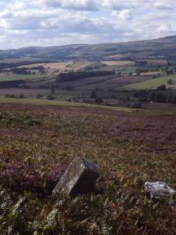
Although there may have been earlier inhabitants, the first evidence we have for human activity belongs to the Neolithic. This comes from the discovery of a flint axe on Cragside Hill and enigmatic cup and ring marked stones, but the remains of any contemporary settlement have never been located. With the arrival of the Bronze Age we have a tremendous number of upstanding remains, including field systems, settlements, standing stones and burials. These are mainly located on the highest parts of the moorland, with numerous cairns situated in prominent positions on or near hilltops. Some of these cairns were burial sites, yet other burials also seem to occur in less prominent positions within cairnfields. However, other burials may have lost their cairns and lie undiscovered beneath the ground, such as the unusual Early Bronze Age tree trunk burial found in the early 20th century. As well as evidence of their dead, we have several good examples of Bronze Age settlements near Debdon Whitefield and on Mount Pleasant. They consist of small groups of unenclosed stone hut circles. Each settlement also has a contemporary field system made up of field clearance cairns and field banks. In addition to these domestic remains are standing stones.
By contrast, the evidence for Iron Age and Roman activity is small. A homestead and defended settlement are known, both at the very southern edge of the parish, each side of the River Coquet.
Like many parts of Northumberland there are no monuments known from the early medieval period. It is only after the Norman Conquest that once again remains of the past can be recognised at Cartington. Cartington is the only medieval settlement in the parish that is known with any certainty. Here, as well as documentary evidence and upstanding earthworks of buildings and ridge and furrow cultivation, are the picturesque ruins of Cartington Castle. This is a fine example of a high status fortified manor house dating back to the 14th century and attests to the troubled nature of the Border region at this time. As the only settlement in the parish, Cartington Castle served as a defended residence throughout the medieval and post-medieval period, surviving damage during a Civil War siege in 1648 and only falling into ruins in the 19th century.
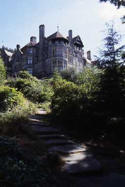
Lord Armstrong figures strongly in the later history of Cartington: he restored the castle in the 19th century and developed many technological innovations at his Cragside estate. Cragside was the first house in the world to be powered by hydroelectricity. The economic life of the parish rested mainly on agriculture, with other minor activities represented by a millstone quarry, lime kiln and coal mining remains. The most recent remains to be seen in the parish today relate 20th century warfare in the form of World War I practice trenches and a World War II pillbox. Today, despite increasing areas of forestry plantation, there are still spectacular moorland walks above the town of Rothbury and The National Trust owns the extensive grounds of Cragside.
N13006
UNCERTAIN
Disclaimer -
Please note that this information has been compiled from a number of different sources. Durham County Council and Northumberland County Council can accept no responsibility for any inaccuracy contained therein. If you wish to use/copy any of the images, please ensure that you read the Copyright information provided.

