Local History
Whittingham and Callaly (Northumberland)
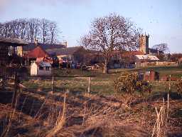
Whittingham parish lies in mid-Northumberland and stretches from the vale of the River Aln to the heights of Thrunton Crags.
The oldest remains in the parish are Neolithic and include a flint arrowhead as well as some of the mysterious cup and ring marked stones from Mountain Farm and Mile Farm. The carved stones were discovered in Bronze Age burials and may have held some significance for a long period of time. Such burials might have contained a cremation or inhumation with grave goods, and may have been covered by a barrow or cairn. A round barrow excavated near Whittingham revealed some pottery, but little else is known about this site and other burial have been found in Thrunton Woods. Other Bronze Age objects have been found in a hoard of weaponry on Thrunton Farm; this may have been a religious deposit as it was found in a patch of marsh had been arranged in a circle.
Two Roman roads pass through the parish: the Devil's Causeway and a linking road to Dere Street. No settlements or military sites have been found in the parish although Low Learchild Roman fort lies just outside the parish.
In the early medieval period there was probably a settlement in Whittingham as the remains of an Anglo-Saxon church can be seen be seen in the fabric of the Church of Saint Bartholomew. Although much of the early church was destroyed in the 19th century, some early quoins in the tower, nave and aisles can be seen. The place-name `Whittingham' itself has the elements 'ham and 'ing, which are thought to indicate early Anglian settlements.
In the medieval period there were villages and hamlets at Thrunton, Eslington, Whittingham and Barton. Traces of the medieval field system still survive as ridge and furrow earthworks at Barton. During the wars between England and Scotland defences were built against Scottish raiders. These took the form of tower houses at Eslington and Whittingham together with a vicar's pele at Whittingham. Some of the boundaries established in medieval times are still visible today, especially on the upland areas of Callaly Moor where a series of boundary stones stand.
Changes in agriculture took place throughout the post-medieval period. These led to changes in settlement and wealth. Eslington Park is an example of such an improved landscape and is laid out around a country house, also called Eslington Park. The poor of parish were catered for when Whittingham Tower was turned into almshouses in the 19th century. Transport was also improved with the first Morpeth to Wooler turnpike travelling through Whittingham from the 1780s, much of which is still followed by the A697 today. The North Eastern Railway also came to Whittingham with the Alnwick to Cornhill line with a fine station at the Bridge of Aln.
N13849
UNCERTAIN
Disclaimer -
Please note that this information has been compiled from a number of different sources. Durham County Council and Northumberland County Council can accept no responsibility for any inaccuracy contained therein. If you wish to use/copy any of the images, please ensure that you read the Copyright information provided.
