Medieval boundary stone 220m SSE of Callaly Crag (Whittingham and Callaly)

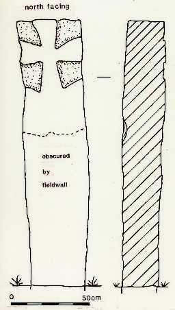
Cross-marked boundary stone on Callaly Moor. Drawn by AUNEE, 1987.

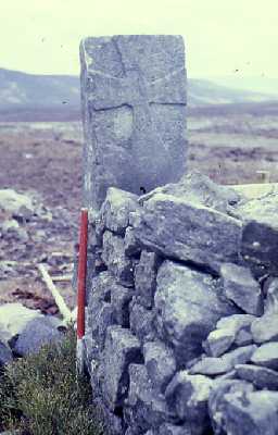
Medieval boundary stone on Callaly Moor.
Upstanding stone slab located adjacent to Old Thrunton Woods and new plantations on Callaly Moor. Abutted by drystone field wall on north side. Has raised splayed arm cross on north face. Background around cross has been pecked out to a depth of 20-30mm, peck marks still clearly visible. May mark extent of lands held by Brinkburn Priory at Thrunton. (1)
Form of raised cross suggests 12th/13th century date. (2)
NU 0628 0904. Medieval boundary stone 220m SSE of Callaly Crag. Scheduled RSM No 20988. A decorated boundary stone of medieval date adjacent to Old Thrunton Woods and abutted on the N by a dry stone wall. The irregularly cut stone of local grey/brown limestone is 0.3m thick and measures 1.7m high by 0.4m across. On its N face there is a carving of a splayed armed cross; the area around the cross has been pecked out to a depth of 20-30mm. the form of the cross indicates a 12th or 13th century date. This stone, along with three others (see NU 00 NE 15, 16 and 17), is thought to mark the limits of an area of land at Thrunton which was donated to Brinkburn Priory in the mid 13th century. (3)
N2762
FIELD SURVEY, Callaly Moor 1987; ARCHAEOLOGICAL UNIT FOR NE ENGLAND
FIELD SURVEY, Callaly Moor Phase Three 1988; ARCHAEOLOGICAL UNIT FOR NE ENGLAND
FIELD SURVEY, Callaly Moor Phase Three 1988; ARCHAEOLOGICAL UNIT FOR NE ENGLAND
Disclaimer -
Please note that this information has been compiled from a number of different sources. Durham County Council and Northumberland County Council can accept no responsibility for any inaccuracy contained therein. If you wish to use/copy any of the images, please ensure that you read the Copyright information provided.