Local History
Shilbottle (Northumberland)

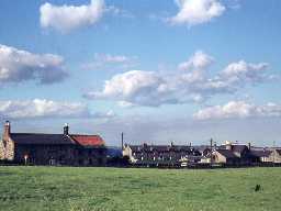
View of Shilbottle village. Photograph by Harry Rowland.

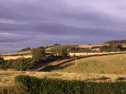
View from Shilbottle. Photo by Glasgow University, 1992.
Shilbottle parish lies in mid-Northumberland on high ground between the Aln and Coquet rivers, with extensive views over each.
The earliest finds from the parish come from the Bronze Age with a hoard of axes found near the Tyelaw Burn in the 1980s. Hoards of metalwork were commonly deposited at the edges of wet- and dry-land.
In the Iron Age it is thought the views of the parish were exploited by a possible hillfort at Beacon Hill, whilst aerial photography has revealed an enclosure north of Shilbottle Grange. Such sites may have continued to be occupied in the Roman period.
Shilbottle is well known in the medieval period. Again the wide views of the parish were exploited by the suggested use of Beacon Hill, which gave advance warning to the people of Shilbottle village. In the event of raids there was some protection provided by The Old Vicarage, a tower house first recorded in the 15th century. The Church of St James also contains some earlier masonry, but has been altered in later centuries. A sword handle found in Shilbottle Wood is thought to be medieval.
Changes brought about in the post-medieval period are well-documented. Shilbottle village was re-planned in the 17th century and has three pants, or water fountains, dotted around the village. Alongside this, new agricultural methods and industry were developing. This included lime kilns at Shilbottle Quarry making agricultural lime, brick and tile kilns using raw materials from an adjacent quarry and clay-pit, and coalmining beneath the parish at Whittle Colliery. In the early 20th century, royalties from coal were taken by the Cooperative Wholesale Society and they developed the village further, including the provision of Aged Miners' Cottages at Leatherland Row built in 1927.
A World War II (1939-45) pillbox at South Moor is a reminder of modern conflict.
N13822
UNCERTAIN
Disclaimer -
Please note that this information has been compiled from a number of different sources. Durham County Council and Northumberland County Council can accept no responsibility for any inaccuracy contained therein. If you wish to use/copy any of the images, please ensure that you read the Copyright information provided.