Local History
Harbottle (Northumberland)

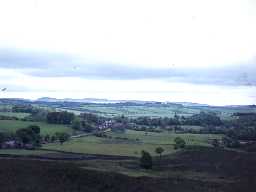
View towards Harbottle village. Photo by Harry Rowland.

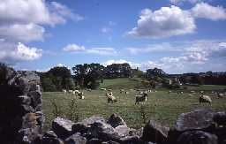
View across fields to Harbottle Castle and village. Photo by Northumberland County Council.
The civil parish of Harbottle lies on the edge of the Cheviots, in Upper Coquetdale. It includes high moorland in the north and west of the parish. The River Coquet runs from north to south on the eastern side of the parish. The centres of population are the villages of Harbottle, Holystone and Sharperton.
Five thousand years ago Neolithic people built an enclosure on Harehaugh Hill in the south of the parish. Some 500 years later, Bronze Age farmers cleared fields and laid out land boundaries that still survive today. The most obvious signs of Bronze Age activity in Harbottle are the many burial cairns, built both singly and in clusters throughout Harbottle. During the Iron Age, people lived in enclosed settlements and in hillforts.
The Roman army built a branch road through Harbottle, linking the fort of High Rochester with Dere Street, the main Roman Road between Corbridge in Northumberland and Newstead in Scotland. A military camp was established at Yardhope, which would have been used by soldiers as a stopping off point on their journeys, as well as a base for the road-builders. Near the camp, a natural rocky gully was turned into a Romano-Celtic shrine with walls, a door, a bench, a roof and a hearth. Outside, there is a carved figure of Cocidius, a local native god. The style of the carving means a Roman sculptor, possibly someone living at the camp at Yardhope, probably carved it.
Although we do not know for certain, some of the farms and villages in Harbottle may have existed as much as 1500 years ago, in the Anglo-Saxon period. Lady's Well is a stone water tank at Holystone, of possible Roman date, fed by a natural spring. The well may have been the site of early Christian rituals. An alternative name for the well is 'Ninian's Well'. Ninian was the Bishop of Whithorn, in south-west Scotland, from AD500-550, and it is possible that he visited Holystone. There is also a legend that Paulinus, an early Christian missionary from Italy, converted 3000 people at the well during Easter 627AD.
Harbottle Castle was built as a motte and bailey castle in the early 12th century and dominated the area throughout the medieval period. There was an Augustinian convent at Holystone in the medieval period. The surrounding villages and farms were at least as populated in the medieval period as they are today. Several deserted medieval villages, (Alwinton, Chiremundesden, Foxton and North Yardhope) exist in the parish.
Many of the medieval and post-medieval farms in the area were built as bastles, fortified against border raiding which was a feature of the region from the 12th century until well into the post-medieval period.
Coal and ironstone were worked in the parish in recent history, but there is evidence that this industry was being carried on much earlier, possibly into the medieval period.
The parish is now entirely rural, with up to 20 percent of its area covered by modern or recent historical coniferous plantations. Part of the parish falls within the Otterburn military ranges, which means there may be restricted access to some areas. Visitors can check accessibility on the Northumberland National Park website at www.nnpa.org.uk
N13387
UNCERTAIN
Disclaimer -
Please note that this information has been compiled from a number of different sources. Durham County Council and Northumberland County Council can accept no responsibility for any inaccuracy contained therein. If you wish to use/copy any of the images, please ensure that you read the Copyright information provided.