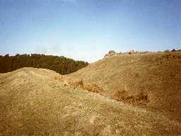
The Ringles defended settlement (Cheviotside)
(NT 98982299) Camp. (1)
A circular earthwork enclosing an area of approximately 1 acre. (2)
Type D (Forts consisting of a mound with encircling ditch). (3)
The Ringles has a diameter of about 70 yards and has been ploughed out except for the west side where traces of three ramparts can be seen. (4)
Defensive situation on top of a prominent knoll. Site is considerably ploughed out and is under pasture. An irregular-shaped earthwork. Ramparts are visible to a max height of 0.5m, but it is difficult to separate natural from artifical, slopes.
To the south-west, the natural slopes are less steep and there are the additional defences of a ditch and outer rampart. Ditch, maximum width 9m, maximum depth 3.5m. Rampart, max width 4m, maximum height 0.8m. Here are possible traces of a rampart on the inner side of the
ditch.
There are no traces of habitation, no evidence of dating. Nearest water supply - streams to north and south. (5)
Listed under pre-Roman Iron Age multivallate (forts, settlements and enclosures). (6)
The major part of the work is virtually ploughed out, but it appears to have consisted of a single rampart following the irregular-shaped summit of a steep-sided hillock, with an additional bank and ditch on the west and vulnerable side. Some accentuation of the main defence here, also, may be the result of scarping the natural slope.
The whole does not achieve the strength of a fort, but is typical of the minor Iron Age defensive works in the area. Published survey (25 inch) revised. (7)
No change since reports of 6/10/55 and 17/10/69; the knoll is still under pasture. Surveyed at 1:10,000 on MSD. (8)
Scheduled. (9)
NT 990 230. Ringles. Listed in gazetteer as a multivallate hillfort covering 0.40ha. (10a)
[NT 9898 2299] Earthwork [NR] (10b)
NT 990 230. Two camps SW of South Middleton. Scheduled No ND/202. (10c)
N1738
FIELD OBSERVATION (VISUAL ASSESSMENT), Ordnance Survey Archaeology Division Field Investigation 1955; A S Phillips
FIELD SURVEY, Hill forts and settlements in Northumberland ; G Jobey
FIELD SURVEY, Hill forts and settlements in Northumberland ; G Jobey
Disclaimer -
Please note that this information has been compiled from a number of different sources. Durham County Council and Northumberland County Council can accept no responsibility for any inaccuracy contained therein. If you wish to use/copy any of the images, please ensure that you read the Copyright information provided.
