Local History
Framwellgate Moor (County Durham)

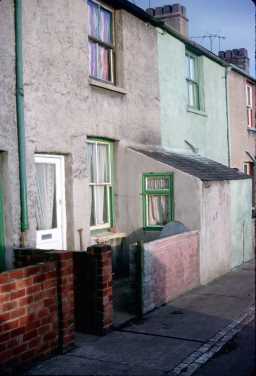
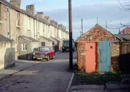
Framwellgate Moor housing, 1972 1/1972

Framwellgate Moor Housing, 1972 1/1972

Colliery Housing Framwellgate Moor, 1971 11/1971
Framwellgate Moor is now a suburb to the north of Durham City, but was once an area of open land to the west of the River Wear. The river was a focus for some of the earliest occupation in this area. A large number of Mesolithic flint tools have been found at Union Hall and Frankland Wood. These early settlers would not have been farmers- they would have moved across the landscape hunting wild animals, gathering wild plants and fishing from the rivers.
Despite these very early remains, we have little other evidence of prehistoric occupation around Framwellgate Moor. It is almost certain that during the Neolithic and Bronze Age this area became increasingly settled. The first farmers would have cleared the land of trees to make simple fields in which crops could be grown. Sadly, no remains of this period have been found. They often leave only very slight traces, most of which have probably been destroyed by the construction of the housing that now covers much of the area.
This lack of archaeological evidence is also apparent for the Roman and Anglo-Saxon periods. It is thought that {Cades Road D3343}, an important Roman road from Roman East Durham leading up to Newcastle and The Wall, passed through the area. There were probably small settlements in the area, but none of these have been discovered. There place-name evidence suggests that there may have been some Anglo-Saxon occupation. Framwell probably comes from the Old English for 'strong spring', and Gate is the Old Norse word gata, meaning street. So Framwellgate means literally 'the street to Framwell'. This suggests that there must have been some kind of Anglo-Saxon or Viking settlements nearby.
In the medieval period the area was an agricultural area, and probably supplied much of the food for Durham City. The so-called 'moor' was probably used to graze cattle, both those farmed locally, and as a place to rest cattle from further away being brought into the city to sell at the market. Crops were also grown, and the corn was probably ground at the watermill recorded in the area.
The area was certainly seen as distinct from the city of Durham, unlike today. Monks from the abbey in Durham even used nearby Finchale Priory as a kind of 'holiday home'. It was suggested that the remains of a building excavated in 1953 may have been the traces of the original house and chapel of Saint Godric, but it is now thought to be an 18th century farmhouse.
Framwellgate Moor saw its biggest period of development in the 19th and early 20th century with the growth of the coal mining industry. Four coal mines were built in this area: Frankland, Dryburn, Framwellgate and Brasside Collieries.
The main colliery was Framwellgate Colliery, often known as the Old Pit. A row of cottages called Old Pit Terrace still mark its site, along the road on the western edge of Newton Hall Housing Estate. It was worked from 1838 and 1924, and was built by the Northern Coal Mining Company. Sadly, all these mines have now closed down, and much of the area has become built over with modern housing.
In the First World War the 17th Century grounds of Cocken Hall near Finchale were used as a military hutment camp and training site. Many photographs are located in the Durham County Record Office that show soldiers stationed at the camp with the Hall in the background. The site today has no extant features of the camp but the photographs might present the opportunity to locate the positions of the huts and recreate a site plan based on the plans of similar installations. The contributions of those of Framwellgate Moor to various world conflicts are commemorated on memorials at a number of locations around the parish including St. Aidan's Church which displays a number of rolls of honour, and the Community Centre which houses the memorial from the building's use as a schoolhouse.
D6797
The identification of Historic Landscapes in Durham Project; Chris Blandford Associates
Disclaimer -
Please note that this information has been compiled from a number of different sources. Durham County Council and Northumberland County Council can accept no responsibility for any inaccuracy contained therein. If you wish to use/copy any of the images, please ensure that you read the Copyright information provided.