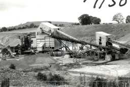
Harehope Quarry, Weardale (Frosterley)
This is a limestone quarry, shown on the third edition Ordnance Survey map (circa 1920), but not on the previous (circa 1898) edition
D66101
Victorian (1837 to 1901)
Cold War (1946 to 1991)
Cold War (1946 to 1991)
Disclaimer -
Please note that this information has been compiled from a number of different sources. Durham County Council and Northumberland County Council can accept no responsibility for any inaccuracy contained therein. If you wish to use/copy any of the images, please ensure that you read the Copyright information provided.
