Sandforth Moor Roman Temporary Camp (Bolam)
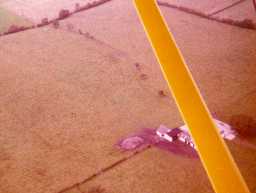
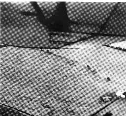
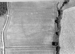
The site of Sandforth Moor Roman temporary camp. The camp survives as cropmarks, and indications in pasture of part of an almost rectangular ditched enclosure resembling a small temporary camp were observed from the air during drought in 1978. It is situated on a gentle south facing slope just below the top of a low east-west ridge. From the crest -line itself, which probably lay within the defended area, there is good visibility in all directions and, in particular, over a considerable length of Dere Street Roman Road (RR 8c); this strategic north-south route passes less than 240 metres east of the probable camp. The Roman fort at Piercebridge is only 5.5 kilometres to the south at the crossing of the River Tees. A complete south ditch, about 84 metres long, and parts of the east and west sides are known, but the field is traversed by well-developed narrow ridge and furrow ploughing and this is likely to have bitten more deeply into the higher part of the slope, destroying any evidence of the camp's north defensive line. No entrance gaps can be identified, but again the erosive nature of the ploughing might preclude the unequivocal survival of such evidence. On analogy with the siting of many other camps, the most probable line for the north defensive ditch would be along the narrow crest of the ridge itself, which runs parallel to the south side of the enclosure and within 10 metres north of the point where evidence for the west ditch fades out. This would give the camp a possible north-south measurement of between 90 and 110 metres, and an area within its perimeter ditches of between 0.76 and 0.92 hectares.
Disclaimer -
Please note that this information has been compiled from a number of different sources. Durham County Council and Northumberland County Council can accept no responsibility for any inaccuracy contained therein. If you wish to use/copy any of the images, please ensure that you read the Copyright information provided.


