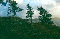
Gordon's Walls, Kielder Water (Falstone)
(NY 70248838) 'Starsley' - farmstead mentioned c.1568. (1)
A steading with an associated garth, the walls of which stand to a height of 2m, set in dense afforestation. The whole has a recent appearance, and the 16th century mention probably applies to the adjacent pele (NY 78 NW 14). (2)
NY 70228838. Gordon's Walls. Remains of a two-roomed stone building with pear-shaped enclosure. Surveyed by Society of Antiquities Newcastle upon Tyne in 1972. The earliest visible remains appear to be the about 4ft thick west wall and lowest course of the south wall which may represent the remains of a bastle. The later rebuilding has not been dated but the associated enclosure is relatively modern, probably 19th century.
The location of this site is on a small hill spur between a natural gulley to the east, and the steep slopes of the Starsley Burn to the west would formerly have commanded extensive views to the south and south west. (3)
The remains are as described by Authority 2, the north west wall (1.4 m wide) and the lower course on the south wall being of a more substantial construction than the steading which measures 19.5m north west-south east by 6.2m overall having walls averaging 1.0m wide. On the whole there is insufficient evidence for classification as a bastle site, or for dating the superimposed remains. (4)
Remains of a long house built from the remains of and on the foundations of a pele. Situated on a rocky ridge. (5)
The remains of the former steading are now utilised as a picnic site east of Kielder Dam. It consists of a linear range of buildings with an irregular enclosure dropping down the north slope. The western part of the range incorporates the remains of an earlier building which may have been a bastle. The best preserved section is the west end, a metre thick and standing 1.5m high, constructed of large roughly squared blocks. Some lower courses of the south wall survive and the lower part of the north eastern angle quoin, incorporated in a later field wall. This thick walled building has measured c.9m by 6m externally; its size, site and the character of its masonry make it difficult to interpret as anything other than a bastle.
The surviving north east corner of the bastle are not referred to in the survey by the Society of Antiquaries. (6)
N6977
MEASURED SURVEY, Excavation and Survey on the Starsley Burn, North Tynedale, 1972 1972
FIELD OBSERVATION (VISUAL ASSESSMENT), Ordnance Survey Archaeology Division Field Investigation 1977; S Ainsworth
THEMATIC SURVEY, Towers and Bastles in Northumberland 1995; P RYDER
HISTORIC AREA ASSESSMENT, Falstone Village Atlas (Historic Tynedale Village Atlas) ; The Archaeological Practice Ltd
FIELD OBSERVATION (VISUAL ASSESSMENT), Ordnance Survey Archaeology Division Field Investigation 1977; S Ainsworth
THEMATIC SURVEY, Towers and Bastles in Northumberland 1995; P RYDER
HISTORIC AREA ASSESSMENT, Falstone Village Atlas (Historic Tynedale Village Atlas) ; The Archaeological Practice Ltd
Disclaimer -
Please note that this information has been compiled from a number of different sources. Durham County Council and Northumberland County Council can accept no responsibility for any inaccuracy contained therein. If you wish to use/copy any of the images, please ensure that you read the Copyright information provided.
