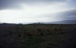
Mare and Foal stone circle, 400m north east of Milestone House (Haltwhistle)
[NY 7253 6633] Mare & Foal [O.E.] (Supposed Remains of a Stone Circle) [T.I.] (1)
To the south of the Roman Wall, two large stones overlook the Carlisle Road. They are probably remains of a stone circle. (2)
These stones existed in 1770. (3)
Scheduled. (4)
Two large free-standing stones (See G.P. AO56/363/1) the survivors of a probable circle 5m in diameter. Published survey (25 inch) correct. (5)
SAM management agreement. (6)
Works in 1993 involved the laying of imported rubble around the base of the stones; this has given the monument the appearance of a neolithic long cairn. (7)
Scheduled. (8)
Included in an area survey at Milestone House Roman camp, May 1984. Report and plan at 1:1000 available in the NMR Archive. (9a)
NY 726 664. 'Mare and Foal' standing stones. Scheduled No ND/38. (9b)
The position of the circle was recorded from aerial photographs as part of the Hadrian's Wall World Heritage Site Mapping Project . (9c)
N6493
FIELD OBSERVATION (VISUAL ASSESSMENT), Ordnance Survey Archaeology Division Field Investigation 1966; R W Emsley
AERIAL PHOTOGRAPH INTERPRETATION, English Heritage: Hadrian's Wall WHS Mapping Project, NMP 2008; English Heritage
MEASURED SURVEY, RCHME: Hadrian's Wall Project ; RCHME
AERIAL PHOTOGRAPH INTERPRETATION, English Heritage: Hadrian's Wall WHS Mapping Project, NMP 2008; English Heritage
MEASURED SURVEY, RCHME: Hadrian's Wall Project ; RCHME
Disclaimer -
Please note that this information has been compiled from a number of different sources. Durham County Council and Northumberland County Council can accept no responsibility for any inaccuracy contained therein. If you wish to use/copy any of the images, please ensure that you read the Copyright information provided.
