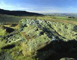
Cup and ring marked stone, Lordenshaws (Brinkburn and Hesleyhurst)
(NZ 05579905) At the point where the old track crosses the hollow way or ancient avenue which takes up to Lordenshaws Camp and at the north-west corner of the junction, there is a flat stone about 4ft high by 5ft wide, which at one time has been up-ended to form part of the avenue and now lies at an angle of about 30 degrees. On the exposed site are ten markings, possibly weathered cups, but must meantime be classed as very doubtful. The stone marks a point where the north wall of the avenue has taken a sweep northwards to enclose a small triangular area forming a kind of bulge. (1)
NZ 05579905 A large stone set upright in the north east side of the hollow way. On its south west face are four well defined cup marks and other depressions which may be weathered cups. (2)
Surveyed at 1/2500. See photographs. (3)
Additional Reference (4a)
NZ 05579905 A large stone set upright in the north east side of the hollow way. On its south west face are four well defined cup marks and other depressions which may be weathered cups. (2)
Surveyed at 1/2500. See photographs. (3)
Additional Reference (4a)
N10748
FIELD OBSERVATION (VISUAL ASSESSMENT), Ordnance Survey Archaeology Division Field Investigation 1956; E Geary
FIELD OBSERVATION (VISUAL ASSESSMENT), Ordnance Survey Archaeology Division Field Investigation 1971; B H Pritchard
FIELD OBSERVATION (VISUAL ASSESSMENT), Ordnance Survey Archaeology Division Field Investigation 1971; B H Pritchard
Disclaimer -
Please note that this information has been compiled from a number of different sources. Durham County Council and Northumberland County Council can accept no responsibility for any inaccuracy contained therein. If you wish to use/copy any of the images, please ensure that you read the Copyright information provided.
