Local History
Kirknewton (Northumberland)

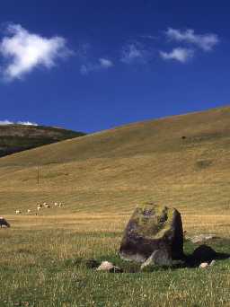
Views across Hethpool stone circle in the College Valley. Photo Northumberland County Council 1994.

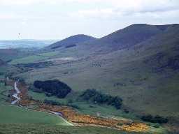
View of the College Valley. Photo by Harry Rowland.
Kirknewton parish covers a large part of the northern Cheviots and lies on the border between England and Scotland. The parish is dominated by the hills either side of the College Burn, including the north side of The Cheviot itself, but lowland areas lie around the fringes, near the River Glen. Both earthworks and standing structures survive throughout the parish.
Although Mesolithic flints have been found in neighbouring parishes, none are yet known from Kirknewton. Likewise, places of early settlement are also absent, though it is probable that Mesolithic and Neolithic people would have settled here. In contrast many religious and ritual Neolithic sites have been discovered. These include the late Neolithic Hethpool stone circle and the cup and ring marked stone at West Hill (unusually of volcanic rock}. People using the nearby ritual sites in the Milfield Basin may have settled in the parish on a temporary basis but so far their settlements have not been found.
Further religious sites are known from the Bronze Age. These include the discovery of an axe on Easter Tor, a hill that overlooks much of the lowland parts of the parish, possibly as some ritual. Further evidence of lowland rituals comes from Old Yeavering Henge, a standing stone called The Battle Stone and further stone circles at Yeavering.
In the Iron Age, hillforts are especially common at the entrance to the various valleys that lead into the College Burn valley. Examples include Great Hetha, West Hill and Yeavering Bell, all accessible through National Park leaflet walks. Long-thought of as purely defensive, recent surveys by English Heritage have shown that it would be impossible to defend some of these sites. For instance, the number of ramparts can vary around the settlement with large numbers occurring on slopes facing other hillforts, but few on the other sides. These banks and ditches may therefore have been built for prestige rather than defence. A good example is Hethpool Bell at the entrance to the main College Burn valley.
People continued to live in many of the same places into the Roman period. At West Hill for instance, a small though crowded, settlement overlies the ramparts of the Iron Age hillfort. It is more rectangular than the earlier settlement, a characteristic seen in many settlements that were built in the Roman period. Prehistoric field systems are associated with these settlements and include traces of cord rig cultivation. How much influence the Romans had in the far north of Northumberland is unknown but a hoard of Roman coins was found in a nearby parish.
In the early medieval period, one of the most important places in the country lay in the parish. In the seventh century, Northumbria was one of the four main Anglo-Saxon kingdoms in England and Ad Gefrin was a royal centre of the kings of Northumbria. The palace lies on one of the terraces overlooking the River Glen and, under King Edwin, it was here that Christianity first found a foothold in the north. The buildings discovered at Yeavering formed part of an Anglo-Saxon royal villa, which would have provided short-term accommodation for the king and his household. The king probably travelled throughout his land dispensing justice and authority and collecting rents from his various estates and visits to Ad Gefrin would have been periodic, perhaps only once or twice a year. You can find out much more about Yeavering at our sister website Past Perfect www.pastperfect.org.uk/sites/yeavering/index.html. At Yeavering, archaeologists have also found evidence of a burial ground with pagan and Christian burials, as well as a temple.
Other medieval sites are less spectacular in wealth and status. Little is known about the hamlets and farmsteads in the Cheviot heartlands, although the remains of a farm near Torleehouse lie close to an earlier farm built in Roman times. Villages developed at Trowhope, Crookhouse and Hethpool and although some failed and became deserted medieval villages, others have lasted such as Kirknewton. The Church of St Gregory at Kirknewton, dates back to the 13th century.
Border troubles later in the medieval period meant the loss of some of the grazing lands. Remains of some of the arable fields have survived as earthworks called ridge and furrow. Medieval farmers ploughed over the stone circle at Hethpool and reused prehistoric cultivation terraces at Hethpool. In the summer months, shepherds took their sheep to the higher grazing land and lived in shielings. The remains of many of these small rectangular buildings survive across the parish, for example near Mounthooly and Southernknowe. Those who could afford it built defensive towers for protection, but Hethpool tower house was probably too small to have ever been used as a permanent home.
The 18th and 19th centuries brought a more peaceful way of life to the Border region of England and Scotland. This was a time of great reform and new developments in agriculture and industry. The famous agriculturalist Matthew Culley who, with his brother George, pioneered new and improved farming methods and livestock breeds is buried in Kirknewton churchyard. Social reformers are also connected with the parish. Instrumental in women's rights and suffrage was Josephine Butler who is buried in Kirknewton churchyard. Industry is limited in the parish, although the Alnwick-Cornhill branch of the North Eastern Railway passes through and Kirknewton station still stands together with other railway structures. The very tranquillity of the area attracted those who made their money in the industrialised Tyneside. People such as Sir Arthur Munro Sutherland, the owner of a shipping line, owned Hethpool House ' though not without some home comforts, as it included one of the earliest hydroelectric schemes in the Cheviots, which in parts survives as earthworks.
N13759
UNCERTAIN
Disclaimer -
Please note that this information has been compiled from a number of different sources. Durham County Council and Northumberland County Council can accept no responsibility for any inaccuracy contained therein. If you wish to use/copy any of the images, please ensure that you read the Copyright information provided.